


VTD-precinct 1, Sully County, South Dakota
About
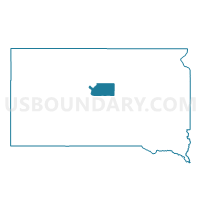
Outline

Summary
| Unique Area Identifier | 667792 |
| Name | VTD-precinct 1 |
| County | Sully County |
| State | South Dakota |
| Area (square miles) | 295.89 |
| Land Area (square miles) | 236.53 |
| Water Area (square miles) | 59.35 |
| % of Land Area | 79.94 |
| % of Water Area | 20.06 |
| Latitude of the Internal Point | 44.68475540 |
| Longtitude of the Internal Point | -100.49456270 |
Maps


Graphs
Select a template below for downloading or customizing gragh for VTD-precinct 1, Sully County, South Dakota


Neighbors
Neighoring Voting District (by Name) Neighboring Voting District on the Map
- VTD-precinct 1, Hughes County, SD
- VTD-precinct 1, Stanley County, SD
- VTD-precinct 10, Dewey County, SD
- VTD-precinct 2, Sully County, SD
- VTD-precinct 27, Potter County, SD
- VTD-precinct 6, Sully County, SD
Top 10 Neighboring County Subdivision (by Population) Neighboring County Subdivision on the Map
- West Hughes UT, Hughes County, SD (2,437)
- South Dewey UT, Dewey County, SD (974)
- North Stanley UT, Stanley County, SD (395)
- West Sully UT, Sully County, SD (385)
- West Potter UT, Potter County, SD (208)
Top 10 Neighboring Place (by Population) Neighboring Place on the Map
Top 10 Neighboring Unified School District (by Population) Neighboring Unified School District on the Map
- Pierre School District 32-2, SD (16,064)
- Eagle Butte School District 20-1, SD (4,830)
- Stanley County School District 57-1, SD (2,966)
- Agar-Blunt-Onida School District 58-3, SD (1,915)
- Hoven School District 53-2, SD (1,127)
Top 10 Neighboring State Legislative District Lower Chamber (by Population) Neighboring State Legislative District Lower Chamber on the Map
- State House District 24, SD (21,361)
- State House District 23, SD (18,409)
- State House District 28A, SD (10,018)
Top 10 Neighboring State Legislative District Upper Chamber (by Population) Neighboring State Legislative District Upper Chamber on the Map
- State Senate District 24, SD (21,361)
- State Senate District 28, SD (19,903)
- State Senate District 23, SD (18,409)
Top 10 Neighboring 111th Congressional District (by Population) Neighboring 111th Congressional District on the Map
Top 10 Neighboring Census Tract (by Population) Neighboring Census Tract on the Map
- Census Tract 9780, Hughes County, SD (3,092)
- Census Tract 9601, Stanley County, SD (2,966)
- Census Tract 9417, Dewey County, SD (2,819)
- Census Tract 1, Potter County, SD (2,329)
- Census Tract 9791, Sully County, SD (1,373)
Top 10 Neighboring 5-Digit ZIP Code Tabulation Area (by Population) Neighboring 5-Digit ZIP Code Tabulation Area on the Map
- 57501, SD (16,309)
- 57625, SD (4,230)
- 57532, SD (2,835)
- 57442, SD (1,664)
- 57564, SD (995)
- 57520, SD (153)